


 Boiler Bay Beacon

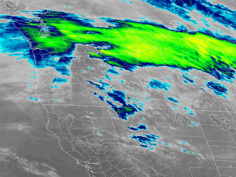
Heavy rain from an atmospheric river is drenching northwest Oregon, prompting state geologists to warn of increased risks for landslides and debris flows that extend to Lincoln County even though it is not named in the primary watch zones.
The Oregon Department of Geology and Mineral Industries issued the alert Wednesday afternoon as the National Weather Service in Portland activated a Flood Watch. It runs from 5 p.m. March 11 through Friday evening March 13 and covers neighboring areas such as the Tillamook and Clatsop county coasts, the North Oregon Coast Range, and adjacent lowlands.
Lincoln County shares the same steep coastal terrain, canyons, and hillside drainages. Heavy rainfall, expected at 3 to 6 inches across the region with higher totals in the hills, can saturate soils and trigger slides along Highway 101 embankments or near streams like the Siletz River and Schooner Creek.
Debris flows are especially dangerous. These fast-moving mixtures of mud, water, rocks, logs, and boulders can outrun a person and travel a mile or more down steep slopes and narrow canyons. Burn scars from wildfires make the hazard worse. Vegetation loss leaves soils water-repellent, so rain runs off quickly and erodes slopes faster. Oregon’s 2025 wildfire season burned about 350,000 acres statewide. Any scarred or disturbed areas, even from smaller or older fires, stay vulnerable during storms like this.
Early Wednesday evening in Lincoln City, gusty winds downed power lines and caused brief brownouts. Those winds can uproot trees on soaked ground, destabilize slopes further, and block roads.
People in Lincoln City and nearby areas should watch for warning signs. Listen for cracking trees, clashing boulders, or initial mud trickles. Check streams for sudden muddy water, sharp drops in flow, or unexpected surges. Any of those mean get out of low-lying spots or steep areas right away.
Drive carefully, especially at night. Embankments can fail and dump debris onto highways. Stay tuned to NOAA weather radio, local emergency alerts, or weather.gov/pqr. Lincoln County Emergency Management may post updates as conditions change.
For more on debris flow safety, visit https://www.oregon.gov/dogami/landslide/Pages/debrisflow.aspx
The storm will bring repeated bands of moderate to heavy rain through Friday.


