


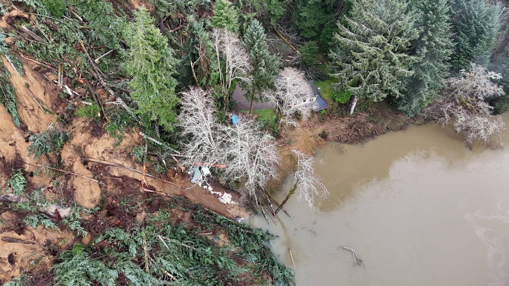
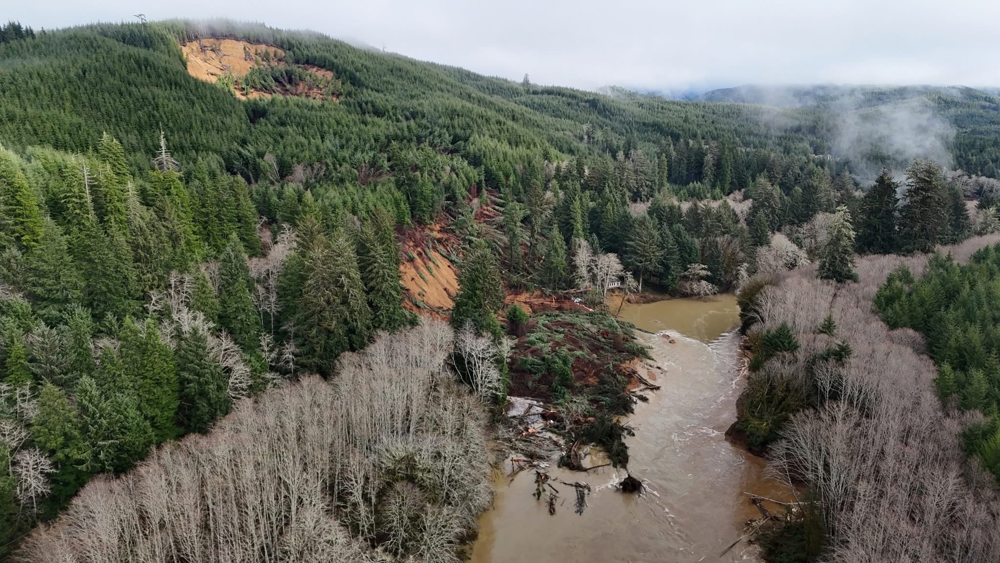
SILETZ — A “massive” landslide 10 miles north of Siletz and five miles due east of Depoe Bay Friday, Dec. 12, that swept a quarter-mile of Hwy. 229 into the Siletz River was predicted by scientists five years ago.
The Oregon Dept. of Transportation said the event, located around, MP 14 was reported about 8:45 a.m. The slide destroyed or heavily damaged as many as five homes, leaving five homeless but uninjured with some in the care of the Lincoln Co. Red Cross.
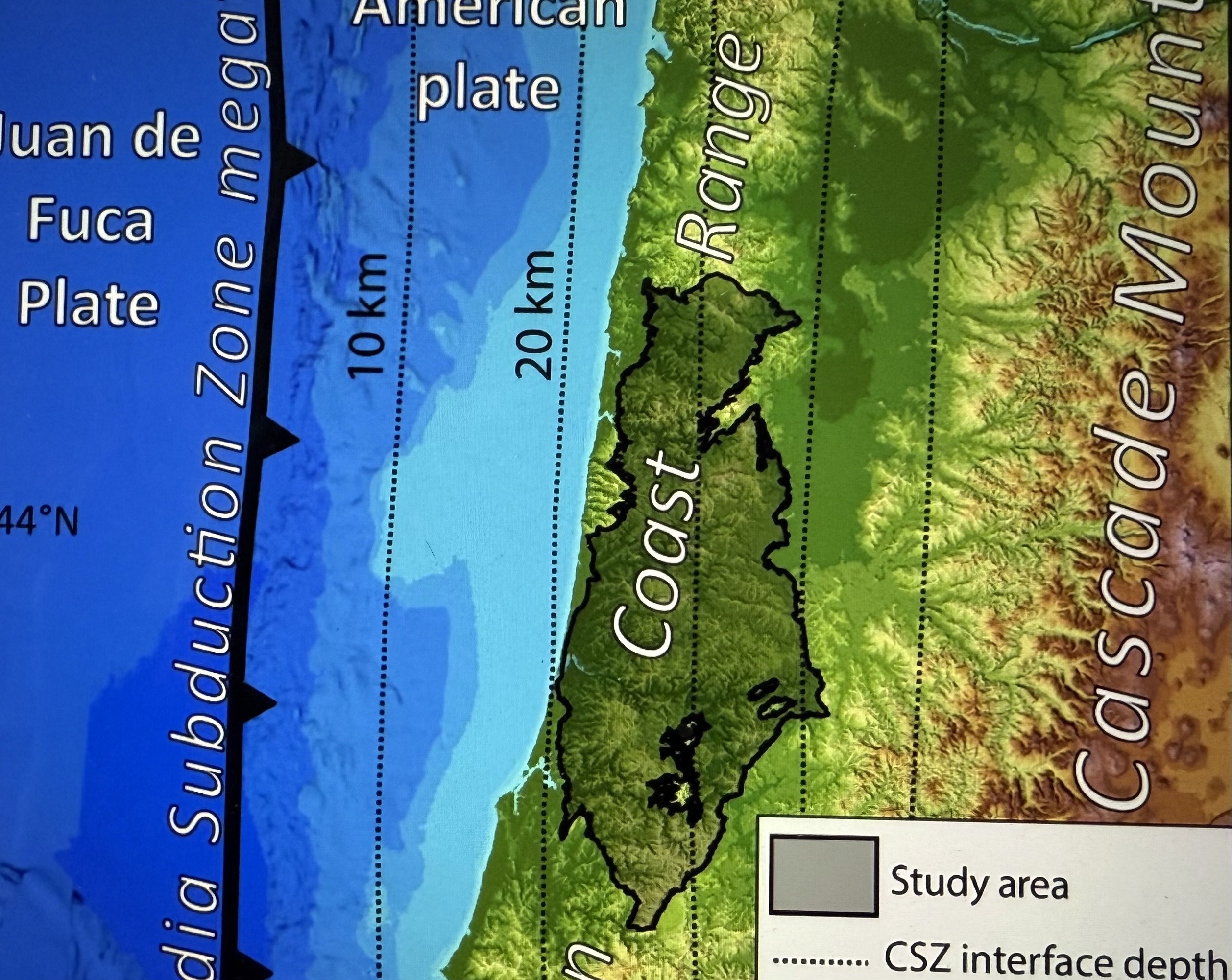
Incredibly, the event — right down to the location — was predicted by researchers five years ago in the journal “Science Advances.” In a paper entitled, “Rainfall triggers more deep-seated landslides than Cascadia earthquakes in the Oregon Coast Range, USA,” the authors studied evidence of nearly 10,000 landslides in exactly the same area of Friday’s landslide. Their conclusion: “most of those events in the Oregon Coast Range were triggered by rainfall.”
They wrote, “Historic deep-seated landslides include a failure that occurred after days of heavy rain in 1975, damming Drift Creek and creating a lake that persists today.”
Records of the National Weather Service (See Beacon ‘Weather’ section) indicate that nearly two inches of rain fell in the Lincoln City-Depoe Bay-Siletz triangle between 3 a.m. Wednesday, Dec. 10, and 5 a.m. Thursday, Dec. 11, an amount that meets the definition of “heavy rain” capable of flooding and overwhelming natural drainage systems. While Lincoln County has received about 60 inches of rain to date in 2025, areas further inland have seen significantly higher totals, reaching up to 79.98 inches so far.
Finger-pointing has already started, with some blaming the logging industry. The landslide, according to ODOT, started on Weyerhauser-owned property. But an Oregon State University professor of forestry, Arne Skaugset, said it’s not that simple.
“Most people who have not studied this issue assume that any landslide that occurs in a harvested unit is caused by logging, and that’s all there is to it,” said Skaugset. “This is not true.”
The problem, experts say, began millions of years ago when what is now the Coast Range was the ocean floor – mostly sandstone with inter-bedded siltstone and mudstone. If you fast-forward millions of years, those ocean floor sediments have been uplifted by geologic forces to form steep Coast Range mountains that are typified by soils of varying depth, sometimes as shallow as only a few feet deep. Water soaks through the soils, hits a less permeable layer and runs along it until it surfaces, forming natural seeps where water accumulates. Then – given the steepness of the land – the heavy, saturated soil slides.
“Erosion has always happened in the Coast Range, and landslides are the primary cause of it,” Skaugset said. “Most of the time, it has nothing to do with land management.”
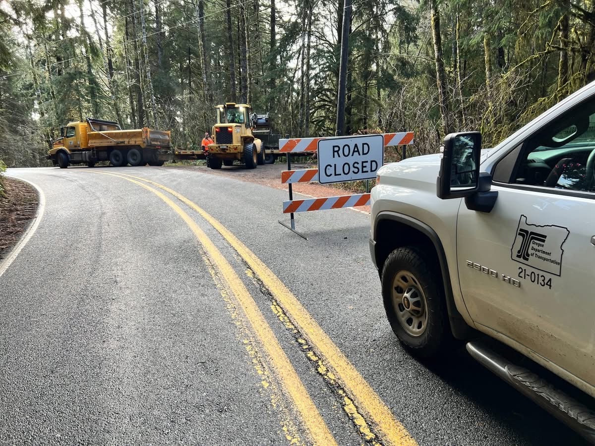
Despite the damage, ODOT officials say they were not caught off guard. Spokesperson Mindy McCartt claimed road crews had been watching Hwy. 229 during heavy rainstorms in the days prior to the slide, checking sunken grades, patching cracks and flying drones over suspect areas.
“Landslides in the Pacific Northwest Coast Range are natural and common, mostly due to the geology and climate,” OSU’s Skaugset said. “They have always occurred and always will.”
Meanwhile, Hwy. 229 has been closed indefinitely at the site, with no date predicted for reopening. It could take “days, weeks or months” to fix the key road, according to highway officials.


Recent (1 and 2 years old) aerial photos of mile 14 slide area show a are soil crack at ridge top and some truck drivers on 229 had commented that crack was visible last summer.