


BOILER BAY, Ore. (MP 126) — They flash by on the roadside like blurred monuments to our progress, but do we really notice and appreciate those innocuous Hwy. 101 mile posts that play an important role in our travels?

First and foremost, you’ll never be lost or stranded again if you can see a mile post. According to the Oregon Dept. of Transportation, the mile post system was established to provide consistent reference points for travelers and emergency services, with extra benefits for navigation and maintenance.
ODOT occasionally updates milepost information to reflect new routes and road improvements. The data collected from mileposts also aids in traffic management and road safety initiatives. The staff of the Boiler Bay Beacon often uses this handy HWY. 101 MILE POST GUIDE to cross-reference accident reports and outdoors stories.
Be sure to print out this guide and keep it in your glove box!
0 Astoria-Megler Bridge, Columbia River
3 Junction with US 30 to Portland
7 Fort Stevens SP 🐚 ⛺, Columbia R
13 Sunset Beach State Rec Site 🐚
17 Del Rey Beach State Rec Site 🐚
18 Gearhart Ocean State Park 🐚
20 Seaside, Necanicum River
22 Seaside, Tillamook Head trail
25 Junction with US 26 to Portland
28 Ecola State Park 12A , Cannon Beach
30 Haystack Rock 🐚 , Haystack Hill SP
30 Tolovana Beach State Rec Site 16
Arcadia Beach State Rec Site 🐚
Hug Point State Rec Site 🐚
40 Clatsop/Tillamook county line
41 Oswald West SP 20 , Cape Falcon
43 Manzanita 🐚
44 Nehalem Bay State Park 🐚 ⛺
46 Nehalem, Nehalem River, OR 53
48 Manhattan Beach SRS 🐚 25
54 Barview, Tillamook Bay
55 Garibaldi, Miami River, Tillamook Bay
63 Kilchis River, Tillamook Creamery
64 Tillamook, Wilson River Bridge
64 Tillamook, OR 6 Wilson River Hwy
64 Tillamook, OR 131 (Three Capes Loop N end – to Cape Meares, Cape Lookout SP ⛺, Sand Lake, Cape Kiwanda, etc.
65 Tillamook, Trask River
66 Tillamook, Tillamook River
70 Rest area
72 Munson Cr Falls SNS
77 Hemlock, Sandlake Rd
80 Beaver, Nestucca River
84 Hebo ⛺, OR 22 , Nestucca River
87 Cloverdale, Nestucca River
90 Brooten Rd (Three Capes Loop S end: Pacific City, Cape Kiwanda, Tierra Del Mar, Sitka Sedge SNA, Sand Lake, Cape Lookout)
91 Little Nestucca River
92 Nestucca Bay NWR
94 Winema Wayfinding Point 👀
97 Neskowin Beach State Rec Site 39B
101 Cascade Head upper trailhead
103 Tillamook/Lincoln county line
104 N Three Rocks Rd: Cascade Head lower trailhead & lower Salmon River
104 Salmon River & estuary
105 OR 18 Salmon River Highway
Note: mileposts skip from 105 to 111.
111 E. Devil’s Lake Rd, 45th Parallel
112 Lincoln City north, Road’s End
114 Devil’s Lake State Rec Area ⛺
115 D River Wayside 45 , Lincoln City
118 Schooner Creek, Siletz Bay viewpoints
119 Lincoln City south, Drift Creek
120 Siletz River, jct OR 229
120 Siletz Bay National Wildlife Refuge
121 Northern third of US 101 in Oregon
121 Salishan Spit 🐚 50 50A 50B
122 Gleneden Beach SRS 🐚 51A
124 Fishing Rock State Rec Site 👀 52
125 Fogarty Creek State Rec Area 52A
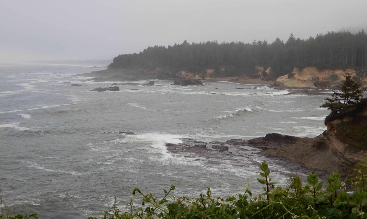
126 Boiler Bay, Government Point
126 Depoe Bay north
127 Depoe Bay: North Point, seawall, harbor, Whale Watching Center
128 Depoe Bay: South Point 129 Whale Cove, Rocky Creek SSVP
129 Jct OR 182 Otter Crest Loop N end (Ben Jones Bridge 👀, Otter Crest State Scenic Viewpoint, Devil’s Punch Bowl, Otter Rock)
131 Cape Foulweather summit
132 Otter Rock from southbound
133 Jct OR 182 Otter Crest Loop S end
134 Beverly Beach State Park 54 ⛺
135 Moolack Beach 55
136 Newport north
137 Yaquina Head Lighthouse & Natural Area
137 Ernest Bloch Memorial Wayside
138 Agate Beach State Rec Site 🐚
Ocean Shore St Rec Area 🐚 , Newport
Newport, jct US 20 to Corvallis
140 Yaquina Bay State Recreation Site 60 🐚
141 Yaquina Bay Bridge 👀
141 South Jetty at South Beach 61 🐚
Oregon Coast Aquarium, HMSC
143 South Beach State Park 61B ⛺
147 Lost Creek State Park 🐚
148 Brian Booth State Park
149 Ona Beach 62A-62B
151 Seal Rock State Rec Site 👀 64
Little Creek Cove Scenic Point 🐚
153 Driftwood Beach St Rec Site 🐚
155 Bayshore 66-66C 67-67D
155 Alsea Bay Bridge, Alsea River
156 Waldport, jct OR 34 to Corvallis
157 Governor Patterson Mem SRS 68
158 Wakonda 69 , The Big Stump
159 Beachside St Rec Site 70 70A ⛺
160 Tillicum Beach (USFS) 71 71 ⛺
161 Colorado Street 72 , Yachats
161 San Marine State Park
162 Salmon Street 74 , Yachats
Ya ‘Xaik Trail, Yachats
163 Smelt Sands State Rec Site 👀 75
164 Yachats, Yachats State Park 76
164 Yachats Ocean Rd St Nat Site 77
166 Cape Perpetua, Devil’s Churn 78
167 Cape Perpetua Day Use / CG ⛺
167 Cove Beach Trailhead 79
167 Restless Waters Trailhead 80
167 Cape Perpetua Visitor’s Center
167 Cape Perpetua Marine Garden
167 Thor’s Well, Cook’s Chasm 81
167 Captain Cook Point
167 Lincoln/Lane county line
168 Neptune North 82
168 Neptune South 82A
169 Strawberry Hill 83 👀 🐚
170 Bob Creek Wayside 84
171 Stonefield Beach SRS 85 86
172 Tokatee Klootchman SNS 👀 87
173 Ocean Beach Day Use 88 (USFS)
174 Rock Creek 89 ⛺
175 Big Creek 🐚
175 Muriel Ponsler State Scenic VP 90
176 Carl G. Washburne SP 91 92 ⛺
177 Hobbit Trailhead 🐚 93
178 Heceta Head Light, viewpoints 94
178 Cape Creek Bridge, Devil’s Elbow
179 Sea Lion Caves 👀
180 Amazing viewpoint turnouts 👀
181 halfway point of US 101 in Oregon
182 Baker Beach 95 95A ⛺
182 Cape Mountain, 3 mi. 👀
183 Alder Dune Campground ⛺
184 Sutton Lake
185 Darlingtonia SNS: carnivorous plants
185 Sutton Rec Area ⛺, Holman Vista
187 Heceta Beach 🐚 96 & 96A
188 Harbor Vista CG & Park ⛺ 🐚 97
190 Florence, Siuslaw River, OR 126
191 Oregon Dunes National Rec Area
192 South Jetty Dunes & Beach 98 – 106
193 Jessie Honeyman State Park ⛺
193 Woahink Lake
196 North Beach, Darlings
197? Westlake County Park, Tyee CG ⛺
198 Siltcoos camping & beach 110 111 ⛺
198 Lane/Douglas county line
199 Carter Lake & Dune Trailhead (USFS)
200 Oregon Dunes Overlook 113 114
200 Lost Lake Campground ⛺
202 Tahkenitch Creek trailhead 🐚
203 Tahkenitch Lake
203 Tahkenitch Landing ⛺
204 Tahkenitch Lake Campground ⛺
207 Sparrow Park Rd (beach) 🐚
209 Gardiner
210 Smith River
210 Bolon Island Tideways St Scen Corr
211 Umpqua River, Reedsport, jct OR 38
211 Oregon Dunes NRA Visitor’s Center
215 Winchester Bay, Umpqua River, dunes
216 Umpqua Lighthouse State Park ⛺
217 Winchester Bay Wayfinding Point
220 Douglas/Coos county line
221 William Tugman State Park ⛺
222 Lakeside, Tenmile Lakes Rec Area
222 Eel Creek Campground ⛺ (USFS)
222 John Dellenback Dunes TH 121
224 Spinreel Campground ⛺ (USFS)
226 Saunders Lake County Park
227 Riley Ranch County Park ⛺
232 Horsfall Dune & Beach, OR Dunes NRA
234 McCullough Memorial Bridge, Coos River
235 North Bend, jct OR 540 Cape Arago Highway (Charleston, Bastendorff Beach County Park ⛺, Sunset Bay SP 135 ⛺, Shore Acres SP, Simpson’s Reef VP, Cape Arago SP 138 , etc.)
238 Coos Bay, Ocean Blvd to OR 540 Cape Arago
242 Southern third of US 101 in Oregon
243 Davis Slough
244 Jct OR 42 to Roseburg
248 Coos County Forest
252 summit, W Beaver Hill Rd to Cape Arago loop
254 summit
257 Seven Devils SRS 142
257 Whisky Run (beach access 143 )
259 Bullards Beach SP ⛺ 144 – 148
259 North Bank Rd, Bandon Marsh NWR
259 Coquille River Bridge
261 Bandon, jct OR 42S Coquille R Hwy
Note: OR 42S is the southernmost major
east-west coast access highway in Oregon.
Bandon Marsh Nat Wildlife Refuge
Bandon South Jetty Park 149 , Old Town
Coquille Point Wildlife Refuge 150
Face Rock St Scenic VP 151 , Bandon
275 Seabird Lane, to parks 🐚 , Bandon
275 Devil’s Kitchen ( 154 sea stacks)
276 Airport
277 Beach Loop Road south, Bandon State Natural Area
278 Bradley Lake County Park, Bandon
New River County Park
279 Misty Meadows, Bandon Crossings
281 West Coast Game Park Safari
282 Fourmile Creek
283 New River Nature Center (BLM)
284 New Lake Rd
285 Coos/Curry county line
287 Floras Creek, New River, Langlois Mkt
288 Public Library, Floras Lake Loop N
289 Floras Lake Loop S, Boice-Cope Park 🐚 , New River
290 Denmark
291 KOA
293 Blacklock Point 🚶 👀, Floras Lk St Nat Area
295 estuary, Sixes River
296 Cape Blanco, westernmost point in Oregon; Cape Blanco State Park 🐚 ⛺
297 Elk River, to Elk River CG ⛺
299 Paradise Point 160 , Port Orford
300 Tseriadun SRS 🐚 , Port Orford
300 Port Orford Heads State Park
301 harbor 162 , Battle Rock Wayside 163 , Port Orford
302 Hubbard Creek 164
303 Scenic turn-out, Rocky Point
304 Rocky Point 165
306 Humbug Mountain trailhead 166 🚶
307 Humbug Mountain CG 166 ⛺
308 Brush Creek canyon
310 summit, scenic turn-outs
312 scenic turn-outs 👀
313 Arizona Beach 167 , Prehistoric Gardens
314 Sisters Rock 168
315 scenic turn-outs 👀
316 jct Ophir
317 estuary, Ophir Trail 169
319 Ophir Rest Area 170
320 turn-outs, Nesika Beach 171
322 Geisel Monument?
323 Agateway, Old Coast Road
325 Otter Point State Rec. Site 172
326 Old Coast Road, N. Jetty 175
327 Wedderburn, Rogue River
328 Gold Beach, Rogue River jet boats
329 Fairground 177 , Visitor Center 178
330 Kissing Rock 179 , Gold Beach
331 Hunter Creek Turnout 180
333 summit
334 Cape Sebastian viewpoint 👀
336 Meyers Beach North 181
337 Meyers Beach 182
337 Pistol River State Scenic Viewpoint North
338 Pistol River State Scenic Viewpoint Middle
339 Pistol River South 🐚 186
342 viewpoint
343 viewpoint, overgrown
344 Arch Rock VP 👀, Boardman State Scenic Corridor
345 VPs, THs, Natural Bridge VP, Spruce Island VP
346 viewpoints
347 Thomas Creek Bridge Viewpoint
348 Indian Sands Trail VP 188
349 Whaleshead Beach 189 , Whaleshead VP 189A
351 House Rock Viewpoint
352 Cape Ferrelo VP, Lone Ranch Beach 337 Meyers Beach 190
353 Rainbow Rock Viewpoint
354 Brookings N
355 Harris Beach SP 🐚 ⛺, Brookings
357 Chetco Point Park, Chetco River, Loeb SP ⛺
358 Brookings, Chetco River, Harbor
361 McVay Rock State Recreation Site
362 Winchuck State Rec Site, Winchuck R, Crissey Field State Rec Site 🐚
363 Oregon-California border
California (Del Norte County)


